176
176
Dec 8, 2012
12/12
by
KRON
tv
eye 176
favorite 0
quote 0
napa as well as fairfield are affected by this dense fog. you can see where this is sitting in the north bay as well as the bay shore area. by 10:00 a.m. we are expected clear skies and it will stay this way for the rest of the after dole. afternos 37 degrees and napa and upper 30's for sunnyvale. that afternoon highs will warm-up to the '60s. it will be 60 degrees for your east bay shore and along the peninsula. 62 degrees is expected for downtown san francisco. there will be plenty of sunshine outside but it will get down to about low 20s. >> for the 7 day around the bay will be plenty of sunshine for the work week. on wednesday there may be showers. >> the rain has stopped, but the problems persist. this is especially for the santa cruz mountains. vine hill road is opened again now but only to one lane of traffic. the slide that washed out the road in scotts valley, is the latest on a long list the road repair projects and the list gets longer with each new storm. there is damage to a least 26 different roles. from the summit to the soque
napa as well as fairfield are affected by this dense fog. you can see where this is sitting in the north bay as well as the bay shore area. by 10:00 a.m. we are expected clear skies and it will stay this way for the rest of the after dole. afternos 37 degrees and napa and upper 30's for sunnyvale. that afternoon highs will warm-up to the '60s. it will be 60 degrees for your east bay shore and along the peninsula. 62 degrees is expected for downtown san francisco. there will be plenty of...
125
125
Dec 3, 2012
12/12
by
KRON
tv
eye 125
favorite 0
quote 0
low forties' for napa in vallejo. temperatures will continue to drop as we head in closer to sunrise. 51 in san francisco. mid 44 redwood city in san mateo. your afternoon highs look like upper 50s low 60s. it will be a cooler after known around the bay area. satellite and radar we will see in increase in a cloud cover through the course of today. into tomorrow we are tracking the potential for some rain. futurecast 4 set of 4:09 a.m. tuesday morning at lot of cloud cover light rain north of santa rosa. the system we are tracking to stay in to win state it is not a huge frame maker compared to what we saw this weekend. 12:00 p.m. tuesday some light rain for vallejo, napa, and fairfield. it is not until later tomorrow night we will start to see rain for the coast line, san francisco. picking up in intensity into the overnight hours. at 9:00 a.m. wednesday we could pick up water rain for parts of the bay area. your kron 4 7 day around the bay forecast is showing we have rain tuesday and wednesday, but overall at quiet w
low forties' for napa in vallejo. temperatures will continue to drop as we head in closer to sunrise. 51 in san francisco. mid 44 redwood city in san mateo. your afternoon highs look like upper 50s low 60s. it will be a cooler after known around the bay area. satellite and radar we will see in increase in a cloud cover through the course of today. into tomorrow we are tracking the potential for some rain. futurecast 4 set of 4:09 a.m. tuesday morning at lot of cloud cover light rain north of...
171
171
tv
eye 171
favorite 0
quote 0
here's a live picture or the napa river in napa. although the town got drenched the river depressed overflow. city officials credit a flood control project still being built as helping get rid of the extra water. we'll have a live report at 6:15. sonoma county, in gurneyville, residents dodged a bullet. the russian river did not overflow. sonoma county received between four to ten inches of rain. residents hope when the tide goes out, the excess water will go with it. >>> there are some flooded streets in san francisco as well as fallen trees, hill -- hill -- lillian him is live. reporter: this is quite a big cleanup job. this large tree came crashing down this morning. as you can imagine for the people who live here, it as quite a scare. >> the family surveyed the damage. luckily no one was hurt but this large tree, which came from the house two doors down, damaged the fence and a tree. their dog was in the backyard when it happened. >> i was there with my dog, and that would happen been just tragic. i'm glad he ran. he has big leg
here's a live picture or the napa river in napa. although the town got drenched the river depressed overflow. city officials credit a flood control project still being built as helping get rid of the extra water. we'll have a live report at 6:15. sonoma county, in gurneyville, residents dodged a bullet. the russian river did not overflow. sonoma county received between four to ten inches of rain. residents hope when the tide goes out, the excess water will go with it. >>> there are...
279
279
Dec 2, 2012
12/12
by
KBCW
tv
eye 279
favorite 0
quote 0
don knapp is in napa. >> reporter: napa residents have been warned about the flooding. especially those living close to streams and the river. now they're bracing for the night. others are still working at it. crews were working into the night to remove about 3 dozen cottages mounted on mobile home frames from the river point resort. the rising river cut short vacations for guests staying in about 30 of the timeshare cottages that are threatened with a possibility of flooding. so far the napa river remains within its banks. it's expected to flood tomorrow around noon. folks aren't taking any chances. city trucks have delivered 50 tons of sand to this lot at first street and freeway drive. folks were filling bags as quickly as the sand came in. nearly 2000 bags were loaded up. >> situation is that i live on a creek. we had a big rain thursday night and the water came up to almost the top of the remaintaining wall. so we decided sandbags were a good idea. >> reporter: are you afraid the water might come over the wall? >> absolutely. >> reporter: the possibilities of flood
don knapp is in napa. >> reporter: napa residents have been warned about the flooding. especially those living close to streams and the river. now they're bracing for the night. others are still working at it. crews were working into the night to remove about 3 dozen cottages mounted on mobile home frames from the river point resort. the rising river cut short vacations for guests staying in about 30 of the timeshare cottages that are threatened with a possibility of flooding. so far the...
246
246
Dec 2, 2012
12/12
by
KRON
tv
eye 246
favorite 0
quote 0
the napa river, at st. helena is expected to crest around noon. with two- feet over its flood stage. the flood stage is at 16 ft.. and if it goes towards map but it could reach its flood stage later this afternoon. >> the russian river? >> the russian river, near well above its flood stage. later this afternoon. as it works down towards guernville. just under 32 ft. and cresting overnight tonight and tomorrow. >> as you move the south and south-east in the santa cruz mountains they have also been concerned as well as rivers and streams. how is that? >> there have been good responses with 2-3 in. of rain fall of the higher elevations. officials are watching that area. the creeks are responding, everywhere. good advice and keeping people away from the water waste. not a good time to be out. be careful with driving through a flooded road race. it is a good way to get into trouble very fast. >> rob, if you're looking later what would you tell people that live along the napa ri in the nab russian river? >> the flow is going to continue to remain high i
the napa river, at st. helena is expected to crest around noon. with two- feet over its flood stage. the flood stage is at 16 ft.. and if it goes towards map but it could reach its flood stage later this afternoon. >> the russian river? >> the russian river, near well above its flood stage. later this afternoon. as it works down towards guernville. just under 32 ft. and cresting overnight tonight and tomorrow. >> as you move the south and south-east in the santa cruz mountains...
504
504
Dec 2, 2012
12/12
by
KPIX
tv
eye 504
favorite 0
quote 0
the napa river at st. helena, a crest expected earlier, two feet above flood stage, at lunchtime tomorrow. we are washing the napa, the petaluma, and also the russian river. i'm kind of amazed that we've had this fire hose of moisture from mother nature for about four or five straight days. there's one more wave of low pressure that's going to move through, then that fire hose will go away, and higher pressure will begin to move in. we have one more low pressure area building in our west and it's going to be headed in our direction overnight. it will be here tomorrow morning. it will be wet, windy. urban and street flooding will be likely. then after that, it's all over. high pressure will build in. and we thankfully will begin to dry out, but not until after another soaker. rainfall totals. new information every hour and everywhere in the bay area will receive another inch to an inch and a half. hayward, you'll get 1.5. two inches for pleasanton, inch and a half for santa cruz. one and a half for santa ro
the napa river at st. helena, a crest expected earlier, two feet above flood stage, at lunchtime tomorrow. we are washing the napa, the petaluma, and also the russian river. i'm kind of amazed that we've had this fire hose of moisture from mother nature for about four or five straight days. there's one more wave of low pressure that's going to move through, then that fire hose will go away, and higher pressure will begin to move in. we have one more low pressure area building in our west and...
166
166
Dec 7, 2012
12/12
by
KRON
tv
eye 166
favorite 0
quote 0
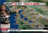
it is down to zero for napa and santa rosa. we are tracking the fog and the temperature has been chilly. it has been low 30's for napa up and up the 30's for--as we take a look if future cast 4 by 9:00 a.m. we will be dealing will widespread 50s. >> it is very similar to yesterday and just a few degrees warmer. for those a you had not this is ending this is what your highs will look like barrett that is not much difference there. >> what are expecting low 60's as well as 63 in santa rosa. it is 62 degrees for napa and the same for downtown san francisco. for those a you head into a tall pole it will be mostly sunny conditions. we're not expecting any more snowfall. >> as we take a look at the 7 day around the bay we are expecting planning of sunshine and it will be slightly warmer for the weekend. we may see a slight chance of showers. >> we have a high spot on westbound 580 at the richmond sand rafael bridge. today it is for a different reason. we do have a accident and i do not know of their injuries. this is arrives at the t
it is down to zero for napa and santa rosa. we are tracking the fog and the temperature has been chilly. it has been low 30's for napa up and up the 30's for--as we take a look if future cast 4 by 9:00 a.m. we will be dealing will widespread 50s. >> it is very similar to yesterday and just a few degrees warmer. for those a you had not this is ending this is what your highs will look like barrett that is not much difference there. >> what are expecting low 60's as well as 63 in santa...
176
176
tv
eye 176
favorite 0
quote 0
nearly 16 inches in -- five-day total impressive, napa river at napa, flood stage getting up there then it made that quick sharp turn now we expect it to stay well below flood stage many st. helena, napa river there got close to flood stage then made an abrupt pull back. russian river is doing fine, close to areas of concern the yellow has made a sharp turn nothing to worry about there. half a mile, quarter mile or less visibility in san rafael, 45° for you where the fog is thickest. san francisco 50, most of us in the 40s this morning same around the monterey bay mid to upper 40s. high clouds and sun today, wet weather tomorrow and wednesday, extended period of dry weather that could last 10 to 14 days. high pressure winning now holding next system at bay overrun by high clouds, making for is up a beautiful sunrise this morning. i'll put them on facebook. here's a look at the rain tomorrow morning, mainly north bay, where it stays for the better part of the morning starts to make a trip to the south around noon into the 5:00 hour, hardly ever makes it into the south bay other night we
nearly 16 inches in -- five-day total impressive, napa river at napa, flood stage getting up there then it made that quick sharp turn now we expect it to stay well below flood stage many st. helena, napa river there got close to flood stage then made an abrupt pull back. russian river is doing fine, close to areas of concern the yellow has made a sharp turn nothing to worry about there. half a mile, quarter mile or less visibility in san rafael, 45° for you where the fog is thickest. san...
143
143
Dec 4, 2012
12/12
by
KRON
tv
eye 143
favorite 0
quote 0
only getting to 59 for santa rosa and napa. 60 expected in the city. satellite and radar showed the rain sagging southward. the cold front is relatively weak in nature. compared to the last three systems we saw we will see a lot of cloud cover. most moisture heads towards the north. 9:00 a.m. picking up light rain and that will be the case throughout most of today. it looks like a lot of cloud cover will stick around waking up 9:00 a.m. tomorrow morning. maybe heavier rain in the north bay and light showers around the city. that will be the case as we head into the rest of tomorrow afternoon just light showers spreading to the bay area and then they will start to taper off. your kron 4 7 day around the bay forecast shows wet weather on tap for part of today and into tomorrow it looks like it will be tried by thursday overall mild conditions as we transition into the weekend. temperatures will be in the '60s. back to you. >> thank you so much erica i think we have a quick check of the traffic. let us go to george. good morning. >> thank you anny it as w
only getting to 59 for santa rosa and napa. 60 expected in the city. satellite and radar showed the rain sagging southward. the cold front is relatively weak in nature. compared to the last three systems we saw we will see a lot of cloud cover. most moisture heads towards the north. 9:00 a.m. picking up light rain and that will be the case throughout most of today. it looks like a lot of cloud cover will stick around waking up 9:00 a.m. tomorrow morning. maybe heavier rain in the north bay and...
163
163
Dec 3, 2012
12/12
by
KPIX
tv
eye 163
favorite 0
quote 0
and well looks like a nice afternoon around the bay area. 59 degrees right now in san jose. 61 in the napa valley and 56 degrees in san francisco. there are changes coming though. high pressure off the coastline but only giving's brief break. look at this. we have yet another storm that's approaching the bay area. so enjoy the break today. looks like tomorrow we get back into it again. some rain developing maybe as early as the latter part of the afternoon in parts of the north bay. most of it comes through tuesday night into wednesday morning. this storm system doesn't look as windy and wet. maybe one to two inches of rain instead every five to eight inches from the last couple of storms. thursday things dry out and that means better weather ahead but we still have that storm to deal with. today 65 degrees in san jose. 46 degrees in redwood city. east bay -- 64 degrees in redwood city. east bay temperatures in the 60s, as well. you will see 60s inside the bay. the next couple of days we'll watch the storm clouds return, again not as strong, don't expect to see any flooding but again more
and well looks like a nice afternoon around the bay area. 59 degrees right now in san jose. 61 in the napa valley and 56 degrees in san francisco. there are changes coming though. high pressure off the coastline but only giving's brief break. look at this. we have yet another storm that's approaching the bay area. so enjoy the break today. looks like tomorrow we get back into it again. some rain developing maybe as early as the latter part of the afternoon in parts of the north bay. most of it...
658
658
tv
eye 658
favorite 0
quote 0
what awaits us this saturday morning. >> north bay, there is fog in napa. that tends to be the worst area right now. we're seeing improvements in concord where visibility is about a mile and a half. outside we go this morning, it is beautiful in lake tahoe. temperatures there, 18 in truckee, 24 in tahoe valley airlift. going to 47 today. only opportunity for snow perhaps on wednesday when we see a few snow showers. it's, nice and sunny downtown one of the warmer locations. approaching 50 degrees and fog really didn't materialize around sfo. live doppler, and from last weekend. we are looking at clear conditions and low cloudiness but otherwise nice and quiet. nora ja to and napa, less than a quarter of a mile around the delta and looking at improvements in the concord area with a mile and a half. so elsewhere from sfo southward we do have clouds around santa cruz but sunshine around mountain view. we're going to see a pretty mild afternoon although right now pretty cool from mid 30s from napa to santa rosa. 45 in san jose and 39 in livermore valley. the fog
what awaits us this saturday morning. >> north bay, there is fog in napa. that tends to be the worst area right now. we're seeing improvements in concord where visibility is about a mile and a half. outside we go this morning, it is beautiful in lake tahoe. temperatures there, 18 in truckee, 24 in tahoe valley airlift. going to 47 today. only opportunity for snow perhaps on wednesday when we see a few snow showers. it's, nice and sunny downtown one of the warmer locations. approaching 50...
248
248
Dec 10, 2012
12/12
by
KRON
tv
eye 248
favorite 0
quote 0
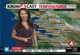
and napa is coming in at the lower 50s. satellite and radar shows that the rigid whether is strong pair was still have offshore winds. >> it will be milder but then the winds will shift and we will see showers come through. any thing that comes from alaska this time of the year will be cool not chilly. it will be a little cooler for tomorrow wednesday is when you were really notice the difference. the temperatures will cool down quite a bit. future cast shows the rain will come through an overnight as your sleeping wednesday morning will see some rain. it is not a huge rainmaker. it >> some spots can get close to 70 degrees today. for the east bay we're looking at mid 60's for hayward and castro valley. danville will be coming in at 65 degrees. for our friends in the north bay downtown petaluma will be coming in at 65 degrees. downtown san francisco will be in the mid 60's. this will be a nice day for you to hang out and the city. here is a look at your 7 day around the bay. it will be mall today, to set will not be too bed
and napa is coming in at the lower 50s. satellite and radar shows that the rigid whether is strong pair was still have offshore winds. >> it will be milder but then the winds will shift and we will see showers come through. any thing that comes from alaska this time of the year will be cool not chilly. it will be a little cooler for tomorrow wednesday is when you were really notice the difference. the temperatures will cool down quite a bit. future cast shows the rain will come through an...
212
212
Dec 7, 2012
12/12
by
KTVU
tv
eye 212
favorite 0
quote 1
patchy and dense fog in napa, novato, livermore. giving you a live look at some sunshine bouncing off that building what. a gorgeous start to the -- what a gore says start to the day -- gorgeous start to the day. we'll see the fog through the next hour or so. getting through the 8:00 hour still gonna be quite chilly. by about 10:00 or so, feeling better, low to mid-50 and then your lunch hour. 62 in hayward. 61 in san francisco. low 60s redwood city, san jose into morgan hill. the extended forecast. the temperatures will warm average by several degrees. afternoon highs mid- to upper 60s back to you. >>> just as some employees get whack to -- get back to work. the new group of workers who say they could be hitting picket lanes during one of the busiest seasons for the port of oakland. >>> swee have new information about a man who took a dangerous fall here in oakland. that's coming up. >>> and could same-sex marriage be once again legal in -- legal in california? ñ? good morning! wow. want to start the day with something heart healt
patchy and dense fog in napa, novato, livermore. giving you a live look at some sunshine bouncing off that building what. a gorgeous start to the -- what a gore says start to the day -- gorgeous start to the day. we'll see the fog through the next hour or so. getting through the 8:00 hour still gonna be quite chilly. by about 10:00 or so, feeling better, low to mid-50 and then your lunch hour. 62 in hayward. 61 in san francisco. low 60s redwood city, san jose into morgan hill. the extended...
318
318
tv
eye 318
favorite 0
quote 0
a little fog by napa, as well, with 45 in oakland. 50 in san jose. you are warmer. look at the 57 half moon bay. 24 hours ago we were chillier. in fact if you are waking up in fremont and livermore, you will notice that the chill in the air and not quite as significant. a little warmer in redwood city, as well as san francisco. so starting out with a few clouds around and some fog in the north bay. otherwise warmer conditions today and tomorrow. we will be well into the 60s. in fact, some areas county could approach 70 degrees by tomorrow. things will turn around. we get a wind shift and it will be cooler, as much as ten degrees cooler and showers arrive overnight tuesday, into wednesday. today forecasting highs from the 60s in richmond, san francisco, and otherwise everyone else will be well into the mid-670s. for this time of the year we are up anywhere from three to eight degrees where we should be. so usually the upper 50s should do it. we do have a couple dry days to boot on top of that. the reason why is because of this, high pressure building into the eastern
a little fog by napa, as well, with 45 in oakland. 50 in san jose. you are warmer. look at the 57 half moon bay. 24 hours ago we were chillier. in fact if you are waking up in fremont and livermore, you will notice that the chill in the air and not quite as significant. a little warmer in redwood city, as well as san francisco. so starting out with a few clouds around and some fog in the north bay. otherwise warmer conditions today and tomorrow. we will be well into the 60s. in fact, some areas...
185
185
Dec 4, 2012
12/12
by
KTVU
tv
eye 185
favorite 0
quote 0
that seems to be the line there, northern marin to napa. 50s on the temps. the associated low is getting -- the atmosphere is getting juiced up. there are a few breaks to the south, light rain to the north. that will pick up later tonight. maybe 1 to 2 inches north of santa rosa. south of that, there will be less. any heavy rain would be late tonight. rain will take us into wednesday morning then it is out of here. the pattern changes thursday, friday saturday and then there will be a cooler pattern. dave? >> thank you. >>> traffic changes if you are driving in san mateo county. >> reporter: and we're live in san francisco where public nudity could be on its way out. what people are saying about it as "mornings on 2" continues. >>> welcome back. 8:28. public nudity faces a final vote today in san francisco city hall. brian flores joining us live from the city with the details of what this possible ban would mean today. good morning, brian. >> good morning, dave. there was a preliminary vote in late november as many people know. this was the scene on november
that seems to be the line there, northern marin to napa. 50s on the temps. the associated low is getting -- the atmosphere is getting juiced up. there are a few breaks to the south, light rain to the north. that will pick up later tonight. maybe 1 to 2 inches north of santa rosa. south of that, there will be less. any heavy rain would be late tonight. rain will take us into wednesday morning then it is out of here. the pattern changes thursday, friday saturday and then there will be a cooler...
272
272
Dec 10, 2012
12/12
by
KTVU
tv
eye 272
favorite 0
quote 0
except some of that patchy fog. 30s, santa rosa, near, napa, antioch is in there. the wind picked up at livermore. they are now 50. 60 in oakland. 52 san francisco. mountain view as well. san jose, sunny and 49. some are cool, some are cold. some are very mild. you can see the ridge of high pressure. the mountain off the coast here. high pressure here. the high doesn't like the low. it's moving from north- northeast. the system in the gulf of alaska is on its way. as it does it will arrive late tuesday and wednesday. you can see the source and that will usher in very warm air. dry weather until then. mild to warm today. maybe a few record highs. had a couple today. would not surprise me one bit. we'll go from near 70 to some. to low 50s, i think by wednesday. today will be warmer for most. some of that patchy fog holding on. breezy at times to windy, blustery. some of the higher elevations coming off the berkeley hills. mount tam, mt. diablo. high clouds starting to move in. maybe late. nice today. sun, clouds on tuesday. rain, a cold rain wednesday morning and the
except some of that patchy fog. 30s, santa rosa, near, napa, antioch is in there. the wind picked up at livermore. they are now 50. 60 in oakland. 52 san francisco. mountain view as well. san jose, sunny and 49. some are cool, some are cold. some are very mild. you can see the ridge of high pressure. the mountain off the coast here. high pressure here. the high doesn't like the low. it's moving from north- northeast. the system in the gulf of alaska is on its way. as it does it will arrive late...
 Live Music Archive
 Librivox Free Audio
 Metropolitan Museum
 Cleveland Museum of Art
 Internet Arcade
 Console Living Room
 Books to Borrow
 Open Library
 TV News
 Understanding 9/11